Company ProjectCommercial · 2025
100-Hectare Integrated Agricultural Development Master Plan
Kampong Speu Province, Cambodia
Project overview
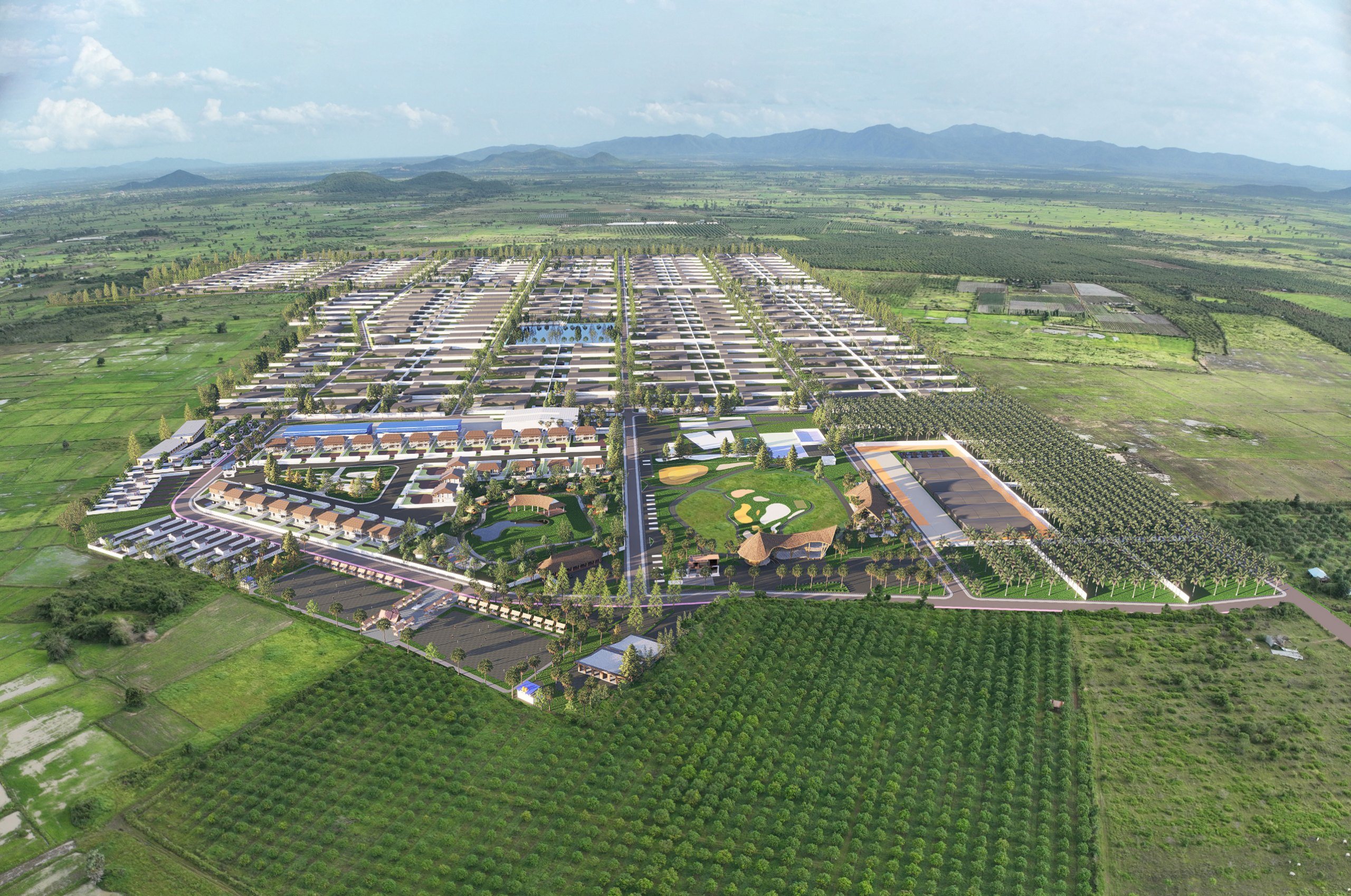
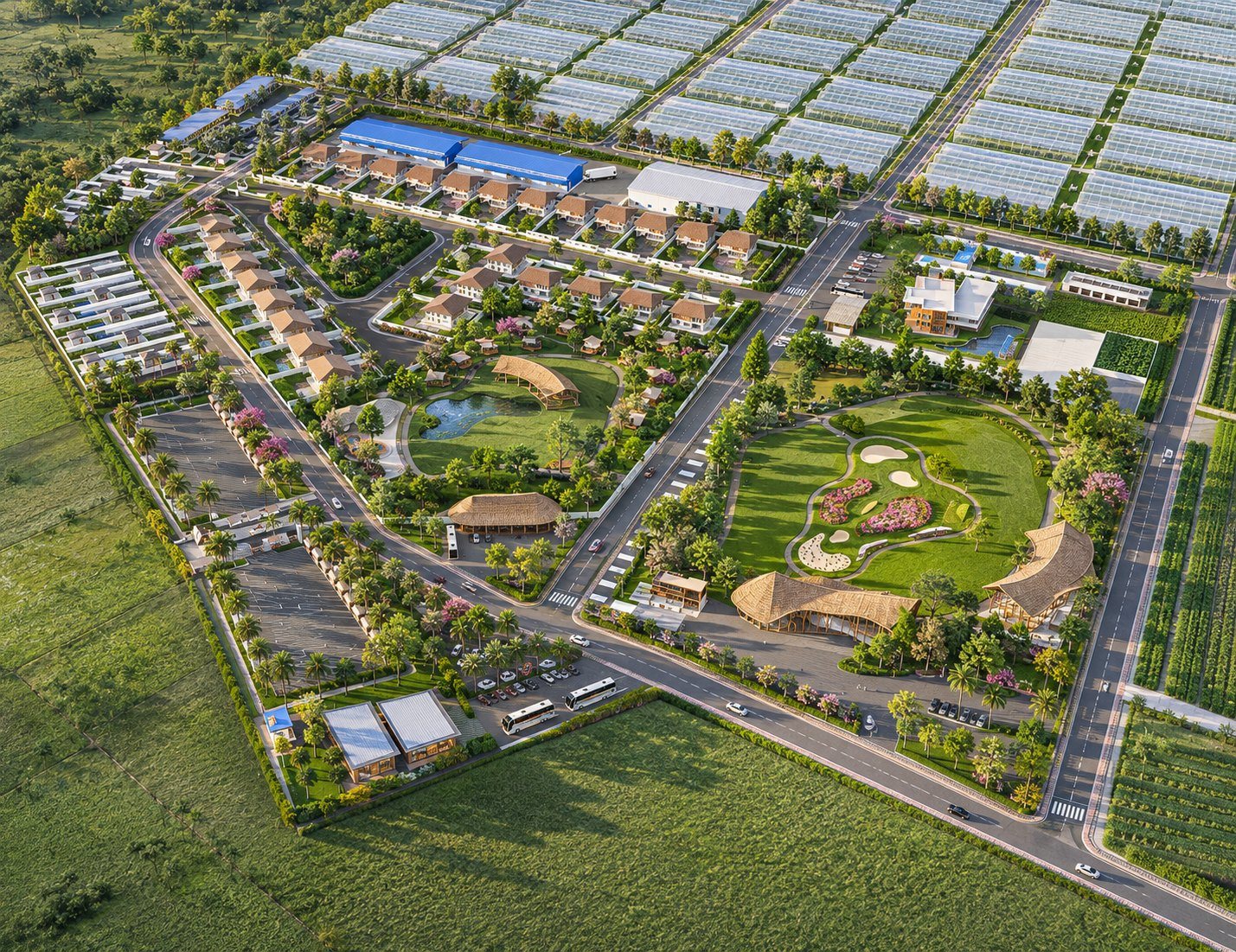
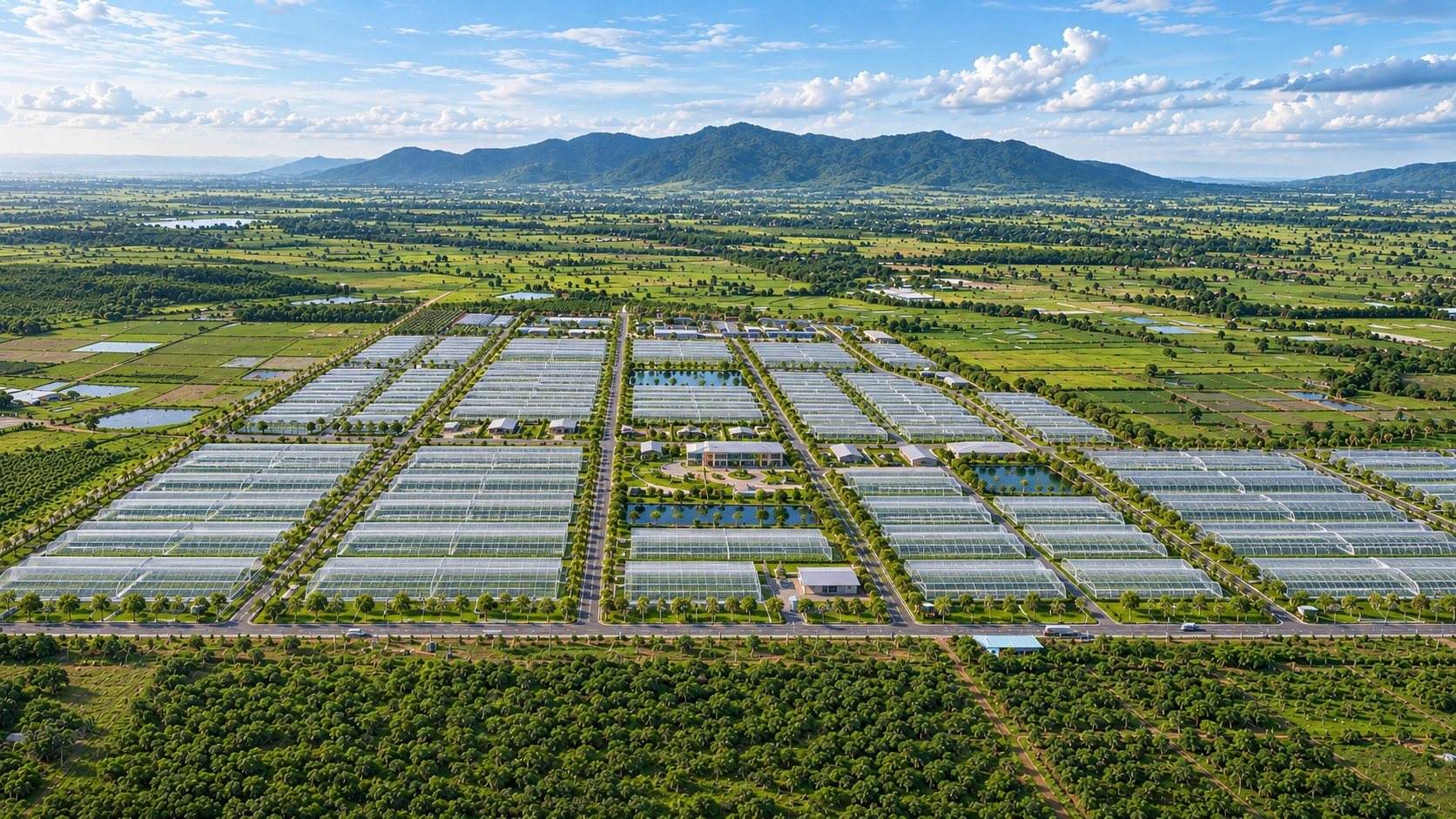
The 100-Hectare Integrated Agricultural Development Project is a large-scale land development master planning initiative located in Kampong Speu Province, Cambodia. The project envisions a multifunctional agricultural estate integrating diverse agricultural activities, supporting infrastructure, residential facilities, recreational spaces, and landscaped environments within a coordinated development framework. Our consultancy role focuses on conceptual master planning, spatial organization, land-use zoning, internal circulation planning, preliminary architectural concepts, and comprehensive 3D master plan visualization. The design approach emphasizes efficient land utilization, functional connectivity, landscape integration, and long-term development flexibility. Through coordinated master planning and realistic architectural visualization, the project establishes a clear development vision to support stakeholder communication, preliminary planning discussions, and future development coordination.
Project details
- Category
- Commercial
- Location
- Kampong Speu Province, Cambodia
- Year
- 2025
- Status
- Conceptual Master Planning & 3D Visualization
- Size
- 100 Hectares
- Our role
- Master Planning, Conceptual Design & 3D Visualization Consultant
- Experience
- Company Project
Scope of services
Highlights
- 100-hectare integrated agricultural development master plan
- Conceptual land-use zoning and spatial organization
- Integration of multiple agricultural development functions
- Internal road networks and circulation planning
- Residential and supporting facility planning
- Landscape, green spaces and recreational area integration
- 3D aerial master plan visualization
- Long-term development flexibility and phased planning considerations
Verified outcomes
- Prepared an integrated conceptual master plan visualization for the 100-hectare development
- Illustrated the proposed spatial arrangement of agricultural and supporting development zones
- Produced a 3D aerial perspective showing the overall development concept
Photographs
Let's deliver your next project with confidence.
Tell us about your project. We reply with the right team and a clear next step.